GeoSIS Platform provides an application platform that combines geographic information and transport databases used to collect, update and work with national transportation road network data. Through the system, people can view information, update, edit routes, besides, users can calculate the speed, control the route, and select the entire route in accordance with the expected route. want.
Assist to manage the asset system on the roads: system of lights, bus waiting points, and quality of roads
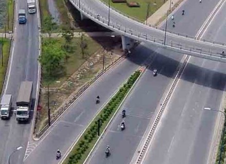
Manage intersections on roads, assess blind spots, control speed, analyze accident situations
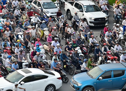
Quản lý tắc nghẽn trên các nút giao, điểm tập trung: Ngã tư, ngã ba, trường học, trung cư, chợ, Trung tâm thương mại,…Đánh giá, phân tích vị trí hay xảy ra tắc nghẽn, giờ tắc, giải pháp tìm đường,..Báo hiệu đoạn đường dang bị tắc, chỉ dẫn đường khác,..
Managing the list of means of transport at landing points (bus stations, seaports, airports, ...); managing departure time, berthing time, parking location at the port; Manage coordinates on the route.
Update, add new, routes: Select graphics and automatic identification of possible routes, tabular tracking and route editor that displays selected connections with route details
.jpg)
Data focus - GIS, planning, protection and operation
Visualize geographic space of traffic routes
Calculate the performance of roads, assess the quality of transport infrastructure
Calculation, route analysis, warning of congestion locations, locations that occur at the route
Manage operating times and destinations of vehicles
Analyzing the causes of incidents on transport routes